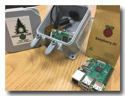
Raspberry Pi
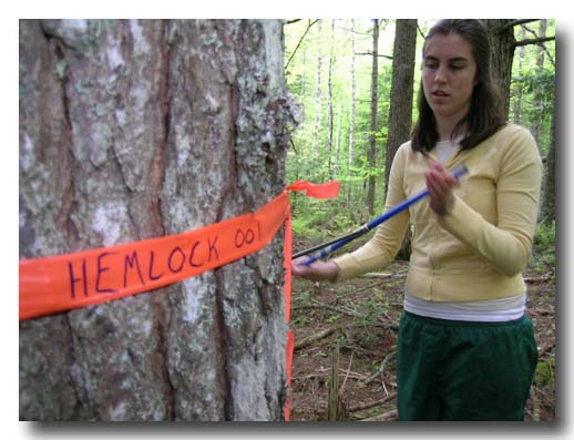
Due to the remote nature of many of the MAD Lab's research sites, they are often visited very infrequently. Unfortunately, wildlife causes thousands of dollars in damage to our equipment at these sites and because we are unaware that his damage has occurred, valuable dendrochronological data is lost due to equipment down time. The Raspberry Pi project was started as an inexpensive way to remotely monitor the status of the MAD Lab's banded dendrometer arrays. Using weatherproofed Raspberry Pi Zero's and camera attachments, the goal is to receive remote updates (via pictures) on the status of our equipment. If damage has occurred, a team can be sent to the site right way to fix the problem and minimise downtime. The hardware portion of the project has been completed, but the software is still in development.
Utilizing Drone Technology in the Delineation of Functional Land Management Zones
As global populations increase and the demand for food security grows, the intensification of agriculture may lead to environmental damage and the reduction of ecosystem services provided by soil. Precision agriculture, an agricultural practice that helps crop productivity, requires creating management zones with each zone receiving specific inputs. Unmanned air vehicles (UAV), or drones, can provide spatial and temporal data that will assist in creating these management zones. Using our DJI Phantom 4 UAV and Parrot Sequoia multi-spectral camera, we are developing new methodologies for delineating management zones that help increase crop productivity and assist in the assessment of soil functions provided within a management zone. The goal is for these "Functional Land Management Zones" to capture key soil properties that not only influence plant growth but other functions provided by soil such as carbon sequestration and biodiversity, and will be used to manage annual cropland and grasslands.
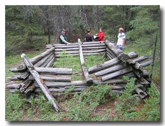
Moose Horn Pass Caribou Fence - Dendroarchaeology in the Mackenzie Mountains
The Moose Horn Pass Caribou Fence site is a collection of three wooden fences located in the Tulita District of the Sahtu Settlement Area, of the Northwest Territories. Situated in traditional Shutagotine (Mountain Dene) territory, it is believed to have been used to assist past hunters in harvesting local game, likely caribou and/or sheep, by steering them to kill zones for harvest. The ages of the features are unknown. Territorial archaeologists recorded the site in 2009, and identified it as being suitable for dendrochronological assessment. The main fence is nearly 800m in length, and terminates in a corral structure after descending from high ground into a valley. The two smaller fences are located north and south of the main fence, and do not descend into the valley. The project is intended to provide a build date for the fences, and to determine, if possible, how they were used and whether they were used together. In other words, were they built at the same time, or are they reflective of changing land-use? Standard dendrochronological methods are being employed to determine the fences ages. To do this, white spruce (picea glauca) trees in the area are cored to determine the overall growth pattern in the local environment. The growth pattern of wide and narrow rings reflects local growing conditions, and is shared by the trees. This pattern of growth, ending at a known point in time, provides a "master" chronology, against which the archaeological wood can be compared for dating purposes. Cross-sections cut from the fences will have their patterns, the "floating" chronologies, matched to the master to determine their ages. Imaging using an unmanned air vehicle (UAV) is employed to seek out high activity areas. This is to be done by using near-infrared imaging to seek areas of high soil compaction. To date two visits to the site have been undertaken, both performed in collaboration with the Government of the Northwest Territories (GNWT) and the Tulita Dene Band.
Boreal Ecosystem Monitoring and Research Sites (BERMS)
The research in question is actively taking place within three of the permanent Boreal Ecosystem Monitoring and Research Sites (BERMS), located in the province of Saskatchewan. These sites are representative of three distinct southern boreal forest types, one old-growth aspen forest, an old-growth jack pine forest, and a mixed black spruce / larch forest. The goal of this research is to provide a comprehensive understanding of stem-level biomass and its role in forest-atmosphere carbon exchange across a diverse set of boreal ecosystems. The unique cross-scale perspective, applied here to the study of carbon allocation in the North American boreal forest for the first time, will shed light on the complex relationship between climate, tree growth, and carbon in the Canadian boreal forest.
Agricultural Greenhouse Gases Program (AGGP) I and II
The purpose of the AGGP project is to give farmers ways to help mitigate greenhouse gas emissions by creating technologies, practices and processes that can be integrated into farming practices. Alongside other researcher groups, we set out to learn more about the carbon sequestration that occurs in shelterbelts on the Saskatchewan prairies. Within that, we wanted to see the life patterns of six shelterbelt species based on differing climates and soil zones in the prairie. To do this, multiple samples of each species were collected all across the prairie and then measured to create a growth chronology. The chronologies were then compared to historical climate records from the nearest climate stations to determine which climate factors positively and negatively impacted tree growth. By learning how a tree species responds to different climate factors we can give farmers the resources to know which shelterbelt trees will thrive in their region, and we can make future projections of how trees will respond as climate change continues to influences temperature and precipitation.
Dendroarcheological investigation of Joggins Fossil Cliff Mine Workings
The Joggins Fossil Cliffs are a popular UNESCO World Heritage site. Easily observable are thick beds of coal layered between rock sheets. Protruding from the coal seams are large wooden pit props once used by early Acadian and British settlers to support mine shafts. These pit props are being actively eroded out of the sediments and lost to the Bay of Fundy tides. This research projects goal is to sample the remaining beams before they and the crucial historical data they hold is lost. The research contribution will be to sample and date the timbers to place each adit and its associated activity in time. The dates once determined will help establish the temporal component of the cliff erosion activity, and at the same time help define which cultural group was actively extracting the coal based on historical documents. By dating the beams, we hope to be able to find a pattern in the ages of the wood that corresponds to historically accepted time periods of high coal production. Although specific time periods of production are known, their exact ground locations are unknown. This information is important to the Joggins Fossil Centre as it is in their mandate to convey accurate information about the cliff sites to the thousands of visitors that walk the beaches each year.

The dendrochronological dating of a sugar maple "hockey stick" from Pottles Lake, Cape Breton, Nova Scotia
The history of the game of hockey is a subject almost all Canadians are very interested in. The discovery of a hockey stick in a Nova Scotia barbers shop could bring the history of hockey in the Maritimes back even further in time than was previously thought. Through historical documents collected by the sticks owner, several proposed dates in which the stick may have been used are proposed, but no physical proof backs any of the dates. The butt end of the stick was scanned in high resolution to avoid damaging the historical artifact, and a tree ring chronology has been measured. Sugar maple trees were sampled in the area surrounding the proposed origin of the hockey stick to try to create a base chronology to match up the sticks pattern. It is hoped that through a continued effort to obtain an old enough base chronology to overlap the stick, we will be able to determine the time frame of when the stick was crafted.
X-ray density at treeline in Labrador
The tree line in Labrador is an area that has had little prior research completed concerning the maximum density response of white spruce to climate parameters. A total of 40 samples of white spruce were collected in the summer of 2009 in a attempt to initiate to rectify this issue. The variation in the response of the white spruce is expected to vary with the different locations along treeline. The main purpose of this study is to examine the response of the maximum density parameter as compared with the response of the total ring width parameter to climate (temperature and precipitation). This project will be completed with the use of the Itraxx X-ray Density machine located at the University of Victoria Tree Ring Laboratory where the majority of the lab sample analysis will occur.

Investigating tree line in northern Labrador
The tree line in northern Labrador is a space where white spruce is the dominant species with a small proportion of the tree population also consisting of black spruce and eastern larch. Our research has suggested that there is long term maintenance of the tree habit due to the presence of old growth at the forest limit. The stands located at the limit are close to sea level and have shown both a north to south gradient as well as an east to west component. We plan to further investigate the unusual composition of these stands located at the tree line. We are determining the effects of climate as well as localized ecological factors on total ring width variation. A genetic component of this study will also examine the genetic variability between geographically isolated tree islands to help understand if the present day tree line mosaic is a facet of genetic movements in a north-south, or east-west direction, or both.

Logs in Bogs
A collaborative research project between the MAD Lab and the Labrador Highlands Research Group of Memorial University is addressing questions that explore annual tree growth sensitivity to past and present climate variability in Labrador. We wish to determine the patterns of tree growth through time, how the climate affects this variability, and what environmental factors are instrumental. Using living tree-ring chronologies from more than 30 sites, we have developed a powerful database to understand how environmental factors control the growth of Labrador trees. Added to this network, we are sampling sub-fossil trees preserved in bogs and shallow ponds on highland tundra above the present day treeline. These attest to more favourable environmental conditions for tree growth in Labrador 3000-4000 years ago. These crossdated tree ring chronologies are being used to generate reconstructions of temperature and/or precipitation that signify what the climatic conditions were like when treeline was higher than at present. The tree ring data from these various studies will improve our understanding of treeline ecosystems in Labrador, with particular emphasis on their sensitivity to local climates, their evolution under past climates, and their predicted response to future, perhaps very different, climatic conditions.
Logs in Rivers
In a related project we are slowly attempting to link
live and subfossil upland master tree-ring chronologies for these same species in central Labrador. All of the main river systems draining central Labrador contain subfossil wood in abandoned terrace sediments. The age of the wood has been radiocarbon-dated to hundreds and thousands of years before present. Dendrochronological analysis of over 150 samples from the Churchill, Goose and Crooked Rivers is providing an initial feasibility study to better understand if the wood samples collected could generate sufficient data to bridge the gap between chronologies. Together, the tree ring data from these various studies will improve our understanding of treeline ecosystems in Labrador, with particular emphasis on their sensitivity to local climates, their evolution under past climates, and their predicted response to future, perhaps very different, climatic conditions.
Spatio-temporal response of four alpine treeline species to climate across central Labrador, Canada
This study compared the radial growth responses of alpine treeline species across a climate gradient in central Labrador. Black spruce, white spruce, balsam fir, and eastern larch were the tree species sampled. From these samples a total of 18 chronologies were developed ranging from the Labrador Sea to the Quebec border. The effects of climate and forest disturbance events on radial tree growth were examined at various spatial and temporal scales. The results suggest that the radial growth response of each one of the tree species sampled is uniquely adapted to monthly and/or seasonal temperature and precipitation values during the growing season and, in some cases, to winter snowfall amounts. These climate sensitivities are also site-specific and indicative of a strong reliance on the proximity of the Labrador Sea. This study simultaneously compares the radial growth patterns of the four alpine treeline species in a region. As a result, this study has identified possible periods of outbreaks of spruce budworm and larch sawfly, which are synchronous with outbreaks reported from eastern Quebec. The high degree of variability in the climate sensitivity of spruce trees across central Labrador is partly due to the effect of spruce budworm outbreaks on the radial growth of trees, but other site-specific factors such as moisture effects must also be contributing to the variability.

Dendroclimatology, dendroecology and climate change in western Labrador, Canada
We are sampling conifers in western Labrador in order to determine the nature of growth-climate relationships in the area. Samples were taken from 12 sites. From these, 24 master chronologies were produced and will be exceedingly useful in future studies. The region is unique in that it is influenced by both maritime and continental climates. Future climate change in Labrador, likely to be characterized by warmer summers and an eastward expansion of continental influences may result in reduced growth at the peak of the growing season. Additionally, increased summer precipitation will result in reduced fire frequency and subsequently greater influence of insect activity upon the landscape. Imminent climate change will precipitate unprecedented changes to Labrador's forests. Further study is needed as we attempt to gain a more complete understanding of forest dynamics in this under-researched region.

Dendroclimatology in eastern Labrador, Canada
Ten sites in eastern Labrador were sampled and at the network of sites, black spruce, balsam fir, eastern larch and white spruce chronologies were collected. Initial results indicate that a zone of maritime and hyper-maritime conditions are able to be traced on the landscape by the trees from their ring record. Key in this relationship is soil moisture content of the area and with it, the complex relationship between temperature and precipitation in this very unhospitible terrain.
Climatic stress and radial growth forecasting of sugar maple across NB and central NS
Radial growth models were developed for sugar maple using climate variables for both sugar maple today and for future forecasts (2000-2100) for areas in New Brunswick and central Nova Scotia. Tree-ring samples were collected from ten sugar maple stands in close proximity to long-term climate stations covering an area of climatic variability. Models were constructed using a stepwise regression analysis which used both monthly and daily variables for the sites. The model outputs were then used to verify the climate variables which were most important to the radial growth pattern of the sugar maples. Late winter thaw/refreeze events are examined for synchrony with sugar maple radial growth reduction periods, and Coupled Global Ocean-Atmosphere Interactions were evaluated for influence on sugar maple climatic response. The forecast model indicates generally decreasing radial growth reductions in the southern sites examined. When all information is synthesized it appears a period of favourable growing conditions may prevail until approximately 2025, after which climatic stress could increase, potentially leading to uneven effects across the landscape causing growth reductions, crown dieback and limited mortality. Consequences of this outcome would be expected to impact the volume of sugar maple sap for use in the production of maple syrup, the aesthetics of fall foliage and various ecological services.
Radial growth forecasts of Tsuga canadensis, Acer saccharum, Picea glauca and Pinus strobus in the Grand River Watershed, Ontario
Changing climates, in conjunction with extremely fragmented landscapes, threaten the health of forested areas in both urban and rural areas of Ontario. Consequently, government officials and researchers are recommending forestry-based adaptation strategies, particularly at regional and local levels. The effectiveness of these adaptation strategies generally rely on the future success of individual tree species. Therefore, researchers have begun using dendroclimatological methods to forecast the radial growth rates of economically, ecologically and environmentally significant tree species. In this study, the growth-climate relationships of four tree species common to the Grand River Watershed are established using historical weather data from the Guelph OAC station. These species-specific relationships are then extended to 2100 using modeled climate data and two SRES emissions scenarios to forecast likely 21st-century radial growth rates for each of the species. Results indicate that the radial growth rates of sugar maple and white spruce will decline throughout the next century, eastern hemlock will remain stable, and white pine will thrive.

Latitudinal gradient analysis of local site factors influencing growth in three boreal tree species
Three common boreal tree species: Larix laricina, Picea mariana and Picea glauca were sampled along latitudinal gradients in northern and western Labrador to better understand how variations in local site factors like foliar nitrogen concentrations and rooting depth affect the radial growth of these species. It was hypothesized that there would be decreased levels of foliar nitrogen and lower growth at more northern sites, while radial growth at the southern sites would be more affected by the local site factors. Although no latitudinal trends were found in this study for any of the species, there was a functional group response observed in terms of the species relationships between foliar nitrogen concentrations and radial growth. Larix laricina displayed increased growth with increased levels of nitrogen which is representative of the performance based growth strategy of this species. Picea mariana and Picea glauca displayed conservative growth strategies with no response and a very weak response, respectively, in terms of their growth rates with foliar nitrogen concentrations. Rooting depth and tree height were also found to be contributing factors in association with radial growth for Picea glauca. The lack of any latitudinal growth responses in relation to the measured variables of this study makes it difficult to predict future growth trends in relation to global climate change, but it does provide an initial understanding of the different factors which could play a role in affecting growth.

X-ray density of eight softwood trees in Sussex, New Brunswick
Five 12 mm increment cores taken from eight different conifer species were collected in the forests surrounding Sussex, New Brunswick in the summer of 2008. These increment cores were used to explore an X-ray dendrochronological technique that has not been explored in any of these species of trees growing in this part of Canada before. The samples were taken to the University of Victoria Tree Ring Laboratory (UVTRL) and were processed in their Itraxx X-ray Density machine. Results were processed back at the Mount Allison Dendrochronology Lab. Standard tree ring parameters were compared to results from the density readings against Sussex instrumental data for both precipitation and temperature. Many of the species illustrated significant correlations with both precipitation and temperature of different months and seasons. The study established a significant correlation between the eight softwood species maximum density parameter and climate parameters at a correlation value well above that which would be found with standard total ring width measurements. The overall conclusion of this study is that density parameters have a great potential to provide better mathematical relationships between climate and tree rings of some species, especially in areas were total ring-widths have been shown to have complacent relationships with climate.
Flow cytometry, lasers and tree rings
Flow cytometry is a process where individual cells are moved through a laser beam. By adding propidium iodide to mark the cells, it is possible to find the length of the cell DNA through the brightness of the fluorescence. Laser light is also scattered by the cell; the direction and intensity of this scattered light is influenced by the shape, size and internal structure of the cell. Although this procedure is common, combining it with dendrochronology (the study of tree rings) is novel. Results so far include building a working flow cytometer with detectors, perfecting a procedure to put tree cells in suspension, and using the flow cytometer to analyze these cells
Dendrochemical Assessment of the Sydney Tar Ponds Site
The Sydney Steel Plant in
We will visit a number of sites within a 1, 3, and
5 km radii of the steel plant site. We will take cores from the most common
tree species in different locations. Upon returning to the MAD Lab, these
tree cores will be analyzed for concentrations of the three most common toxic
metals produced by the steel plant over the past number of decades. Within the final result we will be able
to identify the tree species that best records the heavy metal pollution
emitted from the Sydney Steel Plant, and in doing so, will find the best
environmental indicator to use to track past pollution, and future
remediation
.
Creating an old-growth chronology for trees of Prince Edward Island
Our research project involves creating a time line of ring-width
growth from trees on Prince Edward Island, extending back in time over approximately
the past 250 years. This would at first seem difficult, as anyone who has
visited PEI understands that there are very few old growth trees left on the
island (trees over 80 years old), but this project will involve an unconventional
approach; instead of sampling living trees, this study will sample trees that
were cut over 150 years ago and are presently found as part of PEI�s historical
structures.
This project has three major goals, the first of which is to obtain core
samples of beams from five different historical structures on PEI.
The second goal is to overlap the structural chronologies obtained from the
analysis of the structures with live chronologies that can be accurately dated.
To complete this task, live samples need to be collected from the remnant
populations of trees on PEI. Finally, we plan to integrate these two
types of master chronologies from PEI to extend the various species� ring
records. In doing so, we would establish the first multi-species data
set of tree-rings for the province.
Old-Growth Forest Exploration in
Northern Nova Scotia
Through connections with Nova Scotia�s Department of Forestry, we have information on locations where the province feels that they have old growth forests containing trees that are 400+ years old in the northern region of Cape Breton. The oldest tree ever found in Nova Scotia so far was just over 400 years old, found in southwestern NS. We believe that there is a good opportunity to find even older trees at one of the Cape Breton sites, and if we find them, it would go a long way towards extending climatic records back in time for northern NS.

Dendroarchaeological Dating of a Dugout Canoe
In the summer of 2003 a First Nations dugout canoe was found in Val Comeau,
slightly buried on a beach. The canoe is 4.8m long and through radiocarbon
dating it has been estimated to be around 450 years old. This is the first
dugout canoe to be found in this region that is more than a few hundred years
old. The project now is to use comparisons methods to try to find the exact
date that the dugout canoe was made. Samples of living Eastern White Pine
trees need to be collected and exploration of the site where the canoe was
found will be conducted to try to find trees a match to the tree ring pattern
found in the core samples taken from the canoe. As this is the first dugout
canoe found in New Brunswick that may possibly be from the 16th
or 17th
century, it is important to find an exact date in order to procure it as a
piece of history for the native North Americans of the region and for
proper display at the Museum of Natural History in New Brunswick.

Spatial network of coastal Labrador tree-ring chronologies
This project will define a spatial network (one degree latitude x one degree
longitude) of tree ring sites along coastal
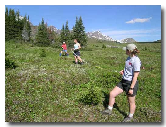
Addressing alpine ecotone shifts in Jasper
National Park
Alpine communities are among the most fragile and sensitive ecosystems
in the world. The forecasted increases in global temperature will likely
have drastic effects on these systems.
The goal of this project will be to evaluate the long term stability of
one such ecosystem, the Cavell Meadows in Jasper National Park, and its
capacity to maintain key indicator species. To measure the threats
to this community, the rate of treeline migration at the meadow/forest ecotone
will be assessed. Using historical climate data and tree-growth rates of
each species present along the forest/meadow ecotone, apline meadow habitat
loss will be charted by tree migration into the meadows. Rates of seedling
establishment and recruitment will be put into a historical context, as
will patterns of growth pulses of the seedlings and saplings on the meadow
edges. From this data, average annual growth rates will be established for
each tree species so that the effects of a warming climate can be guaged.
A sensitivity index will be used to estimate the degree to which environmental
change effects each tree species� growth rates. Age structure analysis will
also be conducted to determine which tree species are expanding their ranges.
Effects of clearcutting
on treed bogs of southwestern Nova Scotia
In Nova Scotia not all peatlands are afforded protection from forestry
activities through buffer regulations. Most wetlands are protected
by adjacent habitat disturbance through the preservation of 20+ m zones of
mostly intact forest along / around watercourses (i.e. buffers); however
wetlands without watercourses, such as treed bogs, have been excluded from
regulations and timber and/or peat harvesting are permitted within them.
This study will contribute to an evaluation of the need to amend buffer
regulations to protect treed bog biodiversity from forestry impact. The
research conducted will attempt to determine how forestry influences the
form and structure of treed bogs by looking how past activity has resulted
in the present state of the peatland. In order to accomplish this,
Black Spruce and Larch species will be sampled in both pristine treed bogs
and treed bogs adjacent to highly forested areas in southwest Nova Scotia.
The annual growth trends of the species will be compared, in order to identify
any discrepancy in the health of the forested and non-forested bog ecosystems.

Extending tree ring chronologies in
southwestern Nova Scotia through old growth forests
The main goal of this project is to locate and sample old-growth stands
for five tree species (Eastern hemlock, white pine, red spruce, cedar, and
balsam fir) in south-western Nova Scotia and to create master chronologies
of radial growth for each of the five species. This will be accomplished
by sampling stands that are in areas that have not been logged in the recent
past. Often these areas are on protected lands, such as wilderness
areas.
By providing annual resolution data on how the climate and the forest ecosystems
have been behaving in the past, this project will provide baseline data
for all projects that are trying to understand how past conditions will
effect future changes. By providing baseline data this project will
lead to a further understanding of the biological response of forests over
time, the way that these changes will effect individual species and landscapes
at risk, and how the biophysical interactions between the climate and forests
of the region have changed over time. Through the establishment of
these past relationships, future relationships can also therefore be modeled.

Forecasting tree growth for five conifer species in the Fundy Model Forest region
This project is an analysis of five conifer species in the Fundy Model
Forest (FMF) to determine their future role in forestry. Recent studies
by the Mount Allison Dendrochronology Laboratory have shown that sensitivity
to climate has the most critical influence in tree growth, depending on
species. The particular effects of climate, such as precipitation, temperature
and seasonality, have been isolated at an individual species level. The
individual species� response functions to climate variables allow for a
growth forecast to be completed for each tree species.
For this study, old stands of important conifer species within the
FMF will be located and sampled to construct chronological records of growth
rates for each species over the past 100 years. The records for each species
will then be linked with past climate records to determine a relationship.
Future growth responses will then use these functions, and an indication
of future forest changes will be gained.

Restoring bog ecosystems to viable
forests
This project is a study of tree growth in a bog environment with the intent
of providing insight into bog restoration in New Brunswick. Peat bogs in
New Brunswick have been exploited for commercial use for over 100 years,
but little is known about how to effectively restore bogs to functional,
productive ecosystems once exploitation ceases. Many peat mining companies
have reached a dense layer of stumps and logs in some exploited bogs, indicating
that those areas were once occupied by forests in the distant past, perhaps
two to three thousand years ago. The peat industry is now considering the
idea of restoring the former forest in some portions of these bogs.
This project will contribute to recent research on forest vegetation restoration
on areas of two abandoned bogs. The growth of trees from buried wood remains
from two ancient bogs in the Shippagan-Lam�que region will be compared
with living trees from two adjacent but modern bogs in the Shippagan area.
At each site, larch and back spruce trees will be sampled, as earlier investigations
have indicated that these are the most common tree species present in the
ancient bogs. The growing conditions of the modern day living trees will
be compared with the buried trees, and by proxy the two environments separated
in time will be compared, furthering the current understanding of possible
methods of bog restoration.
Extending tree ring chronologies in southwestern Nova Scotia through historic structures
The main goals of this project are to locate and sample beams in five old
churches in south-western Nova Scotia; to create master chronologies of
radial growth for each species of wood extracted from each church; and to
add these �floating chronologies� to existing chronologies to extend the
radial growth characteristics for each species in the region. The
project will use the extensive anthropogenic activity in the region to obtain
data on past forests, even though the extensive anthropogenic activity is
the main reason that there are few old-growth forests remaining.
Beams from historic churches can contain well preserved material, suitable
for dendrochronological analyses. The beams of many of the structures
were originally cut from trees very close to the church, were shaped on
site, and thus the beams contain growth patterns for nearby trees.
Therefore core samples will ultimately be taken from old-growth populations
of trees from the region, as they stood when they were first encountered
by humans two centuries ago, using historic churches in the area.
A Parallel Study of
Decay Rates of Two Old-Growth Forests in Atlantic Canada
A parallel study of the decay rate of standing and downed coarse woody
debris (CWD) in a forest in Cape Breton Highlands National Park was conducted
in the summer of 2005. The study was conducted to parallel as many
experimental factors as possible, to a study I completed in the Main River
watershed of Newfoundland and Labrador in 2004.
Detrital samples were typified and mapped using a visual classification
system developed in 2004. Fifty samples from the full range of decay
classes were sampled and transported back to the lab. Base chronologies
from live trees for each of the two dominant species (black spruce and balsam
fir) were sampled from within, and adjacent to, the quarter hectare CWD plot.
Initial results from the 2005 study as well as the relationships that may
be developed to the Newfoundland results will be discussed. It is hoped
that by understanding this component of the old-growth forest a better understanding
of the forest biodiversity and ecological integrity will be understood.
An Analysis of Wood Turtle (Glyptemys insculpta) Growth Rings
The goal of this project is to determine whether there is a relationship
between the annual growth rings formed on the plastron scutes of wood turtles
(Glyptemys insculpta) and local climatic conditions. Individuals
from a Miramichi river population were sampled by obtaining digital images
of the turtle plastron. WinDendro is being used to measure these rings and
this data will be further analyzed by using a series of tree ring software
programs to relate the local climate data to the pattern of ring growth.
This will hopefully generate a pattern of growth based on the dominant climate
parameters and will suggest the degree to which the conditions were most
related to growth. Once this relationship is established, future climatic
predictions from Global Climate Models available from Environment Canada
can be used to generate future estimations of growth for this species.
The longevity of wood turtles generally counterbalances its late sexual maturity
and high nest and hatchling mortality. The decline in adult turtles caused
by habitat loss, highway mortality and the commercial pet trade has upset
this balance. Insight on future growth of young turtles could be crucial
if juvenile survival becomes important for species survival.
Dendroclimatological
Analysis in the Upper Bay of Fundy Region
The rugged Caledonia Highlands region rises up from the powerful tides
in the upper reaches of the Bay of Fundy forming the Fundy Escarpement.
The area has become a focal point for ecological research due to the conflicting
land use goals, which range from intensive logging to conservation zones
including Fundy National Park. Using remnants of the old-growth forest
and tree ring analysis this study has built a 300 year chronology from red
spruce trees. By creating a model of red spruce growth response
to climate, hindcasting is then possible to generate a 300 year paleoclimatic
record, which will be the longest of its kind in Atlantic Canada.
The interpretation of past climates will be applied directly to the diverse
management goals of the region. This will aid conservationists within
the park/protected areas and foresters to anticipate future adaptation required
by many species in response to anthropogenically enhanced climate change.
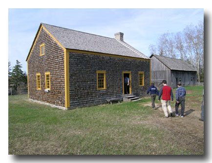
Dans les for�ts
d�Acadie: Dendroarchaeological investigation of Acadian buildings from the
Village Historique Acadien
This research project was carried out to determine the date of construction
of Acadian structures located in the Village Historique Acadien (VHA), near
the town of Caraquet, New Brunswick, eastern Canada. The structures were
of various ages and originally came from different locations throughout the
province. One hundred and eighty two wood cores were taken from timbers in
seven buildings at the VHA. The annual growth rings of the wood were measured
to 0.001 mm precision at the Mount Allison Dendrochronology (MAD) Laboratory,
using WinDENDRO and Velmex measurement systems. The pattern of annual variation
of each sample was matched against existing growth records from the region
to determine the date at which the timber was felled. Confident terminal
dates were found for timbers from all seven sites, and dates of construction
were extrapolated from this information. Constructions dates ranged from
1773 to modern (c. 1970). Some of these dates confirmed estimates
made by VHA historians, while others were older or younger than originally
expected, allowing a
more informed appraisal of the historical value of each building. Data
from the analysis was also incorporated into existing MAD Lab data sets,
thereby strengthening and extending local red spruce (Picea rubens),
eastern white cedar (Thuja occidentalis) and eastern white pine (Pinus
strobus) chronologies.

Dendroarchaeological
Investigations in Dorchester, New Brunswick
The results of a dendroarchaeology study from the Mount Allison Dendrochronology
Lab (MAD Lab) of a historic house located in Dorchester, New Brunswick will
be discussed. The history of the lot of land in which the house sits has
been well recorded since its creation in 1786. The original inhabitants of
the house itself, however, have remained a mystery until this summer. The
current owners of the house in question suspected that it was constructed
sometime during the first decade of the 1800s by a man named Cyprian Killam.
Our dendroarchaeological study indicated that the original building was probably
constructed in the period from 1820 to 1821. Thus, the age of the house,
the original inhabitants of the building and a much clearer history of the
site were uncovered by the study. To achieve the date of the house,
many other structures had to be investigated using historical and dendroarchaeological
methods due to the lack of old growth forests in the region. As a result,
a mixture of regional churches, historical buildings and living trees were
sampled to create a chronology that was locked in time in order to successfully
cross-date the building.

Wind Energy Project
We
hypothesized that substantive long-term winds and their effects can be demonstrated
by studying the ring patterns of trees that are exposed to prevailing winds.
This proposed analysis of wind-affected tree-ring patterns could help provide
a rationale for the larger investments of equipment and capital needed to
complete a detailed year-long wind site survey, necessary for most wind
energy power production. This study will endeavour to find a correlation
between the growth patterns of tree rings on wind-affected trees (flagged
trees) and local wind data.

Southwestern Nova Scotia Paleoclimates
This summer we initiated high-resolution (annual to sub-annual) reconstructions
of climate over the last 500 years in southwestern Nova Scotia. Initial
work concentrated on establishing radial growth/climate relationships over
the period of instrumental data, and determining which tree species in southwestern
Nova Scotia are best suited for dendroclimatological analysis. This project
is supported by a research network that includes Acadia University, the
Atlantic Region of the Meteorological Service of Canada, and the MAD Lab.
Treeline at Maligne Pass
In conjunction with Parks Canada, the MAD Lab conducted a vegetation analysis
of the Maligne Pass area in Jasper National Park to see how the landscape
has changed over the past 100 years. The assessment, whch also makes use
of historical photographs, will enable us to estimate how much meadow habitat
has been gained or lost. In addition, it will indicate when and how quickly
the treeline might have migrated and will also permit us to determine if
migration is still occurring.
Jasper Park Historical Structures
The main objective of this research project is to use tree-ring analysis
to find the construction dates for structures of interest to Jasper National
Park's cultural resource officers. These structures have never been dated
and their histories are slowly rotting away. Through dendrochronological
methods, we will establish the age of each structure, and in doing so, create
a starting point for further reasearch regarding each structure's historical,
social and cultural significance. This information is critical in allowing
Parks Canada staff to better understand the cultural values that are inherent
within their boundaries.
Dec 4, 2017